


- You are here:
-
Home

- Tourism
SIGIRIYA


Meaning of the “Sigiriya” can be denoted as Lion Rock. Built up of the gateway in the form of an enormous lion is caused for it.There was a sculpted lion's head above the legs and paws flanking the entrance, but the head collapsed years ago and the ruins of the lion image also can be seen yet through the two giant legs remain in bi face of the foundation of stair case.Actually, it was become as a palace due to usage of the Sigiriya as the political centric of the Sri Lanka for one and half decades. Sigiriya may be the best-conserved place among the planed cities that belong to the first millennium at the South Asia and South-East Asia. Sigiriya has acquired an exceptional place of the creation of metropolitans in Asia due to numbers of reasons such as flamboyant surrounding, artistic plan and conserved nature. Urban nature of Sigiriya had created by adding numbers of centric surroundings and it has totally planned as a massive premise which boarded by the outside watercourse. Urban nature of the Sigiriya was built by adding the number of centric surroundings and it has planned as a mega institutional premises which surrounded by entirely the external water trench.(This creation has not make reveal completely yet). This landscape has designed by focusing the great Sigiri rock.Plan of the city was geometrical oblongshape, extent of it is 3km from East to West by length,and the width indicated 1 km from East to West.
Though Most of visitors believe that the construction exist in the site of Sigiriya is belong only to the reign of Kashyapa(5th century). Thus, it has proved through archeological proves that there were abide few reigns of pre and post period of Kashyapa reign.
Sigiriya was a creation done by King Kashyapa I at 5th A.D. The most famous Archeological Treasure and UNESCO named Sigiriya rock as a World Heritage in 1982 under the name “Ancient City of Sigiriya Sri Lanka”. It can be denoted as a place that depicted the Town Planning Methods, Arts, Architectural talents, Construction Technology, Lands ScrappingGardens Arts, and Assemblage of Water Management.
Sigiriya has identified as a fortress in prime time and as a city later by Archeologists.Eight of (08) historical phases of Sigiriya have identified by archeologists as per the archeological researches that done sofar.
Ancient Arama Era – Brahmi inscriptions that indicated the offerings by made possess to ven.sangha aboutcaves with vat situated at underneath of Sigiriya Rock from 3/2 B.C to 1 A.D were belong to this era.
- Phase before Kashyapa Era–History of this era from 1centaury A.D to 5 is uncertain.
- Phase–Kashyapa Era- 477-495 A.D
- Phase–Post KashyapaEra - PostArama Era up to 6-7A.DCentaury
- Post KashyapaEra -Relinquishment Era–up to 13-17A.D Centaury
- Phase Kandy Era - 17-19 Centaury
- Phase – Phase Contemporary Renovation– Few complicated partsfrom about 1830 years to 70 decade.
- Sigiriya Rock and castle on it
- Water Garden, Parks, West land side contains with External Water Trenches and Ramparts
- West landside contains with External Water Trenches and Ramparts
Sigiriya has become a tourist attractive location historically due to the world famous frescoes andhundreds of Graffiti written on the mirror wall in addition to theabove-mentioned decorative constructions.
DAMBULLA
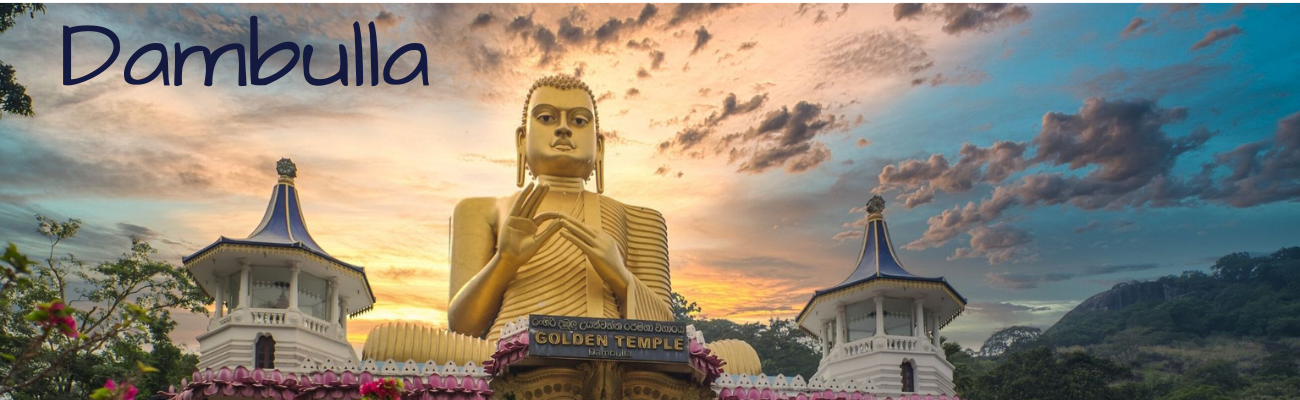
Dambulla can identify as a venue that heritage to the cultural triangle of Sri Lanka. The significant heritage here is the five caves of living rock with murals and sculptures, which exist naturally. The pre- Brahmi inscriptions belonging to the third century BC and the murals in 18 A.D reflects the evidence of human activities over a long period in this place. UNESCO Organization declared this location as a world heritage place in year 1991. The Dambulla Project of Central Cultural Fund had implemented a project on conservation of murals from year 1982 to year 1998.
The Dambulla project, which had being functioned as the only research center into murals and the headquarters of mural conservation, maintains the only mural museum of Sri Lanka. In addition, mural conservation of surrounding temples is done by this Project centered on the Dambulla Cave Temple. This purpose of this museum is to allow witness and study the wall paintings that were uncovered by the Dambulla Project through surveys and researches.
The Dambulla Museum is the only one of its kind in Sri Lanka, which specifically functions with the aim of exhibiting paintings of Sri Lanka, including the famed Sigiriya frescoes, and wall paintings at a number of ancient temples ranging from Anuradhapura period to the modern era.
IBBANKATUWA
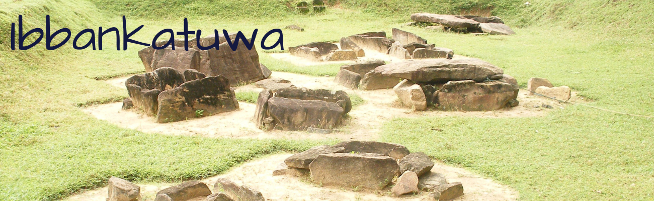
Ibbankatuwa is an early Iron Age burial and habitation site (6th century BC) located a village called Ibbankatuwa in Talakiriyagama (about 3km south - west of Dambulla city Sri Lanka) near the 90th milepost on the Kurunegala - Trincomalee road. Geographically it is situated on the upper reaches of the Kala oya basin. Ibbankatuwa prehistoric burial site, which covers an extent of approximately 13 Hec. KM and Ibbankatuwa Megalithic Burial is one of the largest and best-preserved ancient burial grounds in Sri Lanka. Ibbankatuwa ancient cemetery dated back to the first millennium BC (circa 1000-300 BC), the Iron Age agrarian village settlement associated with this Ibbankatuwa burial ground belongs to the settlers and farmers of the proto and early historic period. Dr.Raja De Silva, Former Commissioner of Archeology in 1970, did first Archeological research regarding this burial ground. Central Cultural Fund, Archeological Post Graduate Institution and “kawa” of Germany (The Kommission fur Algemeine und Vergleichende Archaeologies), have found 21 of Tombs through researches done by them. Charcoals, which found through the research done at this place was disclosed that it belongs to century of 6 B.C.
The Early Iron Age communities established their settlements in the Ibbankatuwa area due to several positive factors, which are directly, affect to their day-to-day life especially geographical facts. Excavations of the burial grounds had done again by Central Cultural Fund in year 2015. It had done at a place extent of 10x10 where near to the 21 of tomb place that excavated previously. It was able to find another 47 tombs after removing the soil of the excavated land. . It has yielded 26 terracotta urns containing cremated human remains and rich finds of grave articles in the form of pottery and beads of high craftsman ship.
Each tomb made out of a simple floor slab, four upright stone units and a capstone forming a rectangular chamber. Caps of stones covered some of the top of tombs and clay pots with vivid quantities were deport in the tombs.it was containing cremated human remains. These vivid forms of potteries belong to “Kalaraktha” clay pots and Category of Red Clay Vessels. In addition to this,21 out of excavated 47 of tombs were made by deporting clay urns that contain cremated human remains. These were called as “Barani” Cemeteries. Ibbankatuwa is the largest cemetery, which found out of all pre-historic cemeteries in Sri Lanka. This Cemetery has expanded in extent of 400m 700 m of land. This is the settlement and affiliated cemetery, which, belong to the iron era of Sri Lanka When considering with the “Polwatta” Settlement located near to the Ibbankatuwa.
NALANDA GEDIGE
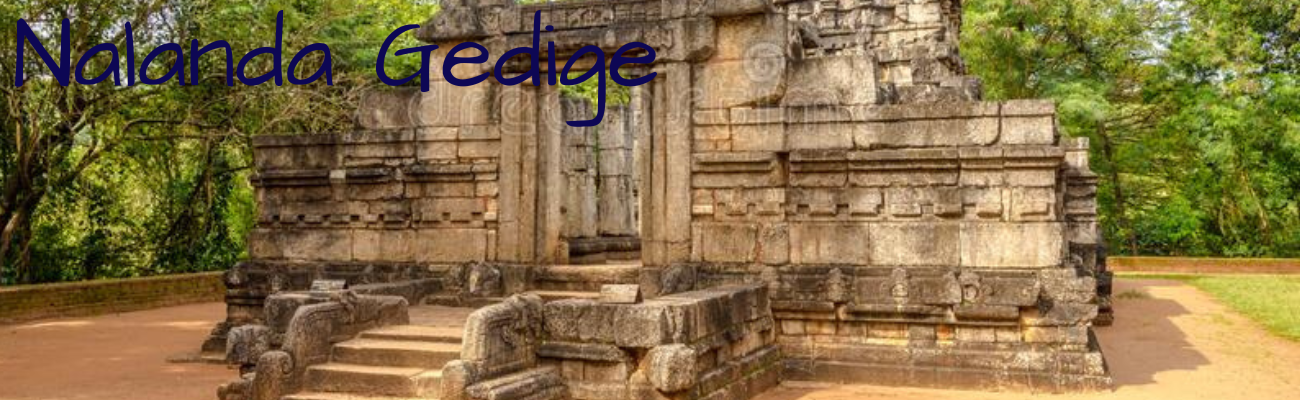
This place situated near Bowatenna Reservoir at Dambulla Road. Nalanda Gedige is a very granite-based creation. According to what historians and archaeologists have discovered about Nalanda Gedige; the structure was created between the 8th and 10th century AD and it was created by using the Pallawa architecture Skills when the most developed era which is considering as Narasinghe Varman alias “Malla” style , existed from 6th and 9th empiric era.
It is strange mix of Hindu and Buddhist architecture. Believed to be at least a thousand years old the structure; the structure was rediscovered in 1893 by the Archaeological Commissioner of Sri Lanka at the time, H. C. P. Bell.
NalandaGedige was designed in the standard framework of a Hindu temple; with a Mandapams or halls used for events, an entrance passage which was originally roofed, a main central shrine, and an ambulatory round this holy center
NalandaGedige was a bold attempt at a fusion of Tamil and Sinhalese cultures; while others say the structure started out as a Hindu Temple constructed in the Pallava style, which was used later by Buddhists. richly decorated facade sections is believed to be of South Indian design from the era of the Cholas and Pandyas; but the appearance of the god of wealth, Kubera, seated on a lotus plinth in the a semi-circular niche on the southern section, is a feature only to be found in Sri Lanka. There are also eroded Tantric Buddhist carvings of an erotic tone, much like the famous ones at Khajuraho in India.
Nalanda Gedige is the only remained Buddha chamber, which constructed according to the Pallava tradition presently in Sri Lanka.
It has used few proofs for this creation and those are as follows. Influence of Pallawa style has reached to creations of Sri Lanka after 691 A.D. it has affected the contribution of king Narasinghavarman II who was assist to acquire the power of reign to Sri Lankan prince Manawamma by defeating the King haththadhata who was ruled Sri Lanka at that moment.
KALUDIYA POKUNA
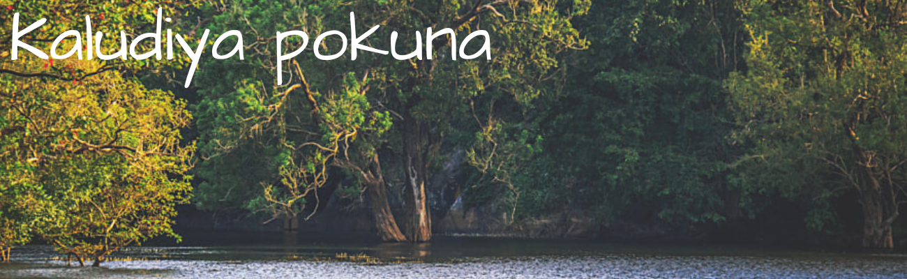
This Place has located at Kumbuk kandanwala which far about 8 Km from the Sigiriya in Dambulla DS Division. The Place that established in a wooded area has denoted as “Dakkhina Vihara” by an inscription, belong to 9th Century.
According to the Mahawansha this Vihara has constructed by King saddhatissa in (137 - 119). It has further improved by King Aggabodhi (578 - 612) through construction of a chapter house. Numbers of inscriptions, few caves that engraved drip ledges, a Stupa and stone pillars also several ruins of Monastery can be seen at the place. Thus, A pond fills with dark color of water which is existing little distance away symbolize the name of this place as “Kaludiya Pokuna.”
It is also home to a wide variety of birds and butterflies, as it is at the junction of different climatic zones with some species being at an extremity of their range. Clearly, it is an exciting place for birders and butterfly watchers.
SERAELLA
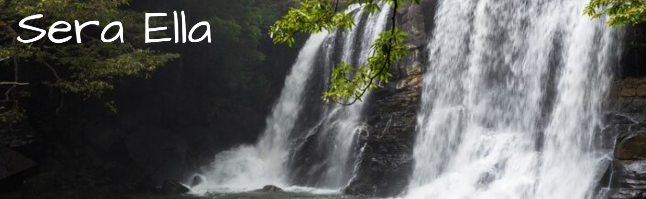
Seraella acquires a significant place amongst hundreds of scenic spots, which covered in Dumbara range. The junction that leads to the Sera Ella can be met when travelling from Matale via Rattota by passing the revere-stone mountain and Pitawala plain. The road, which turns to left from the said junction, is directly leading to the Poththawela village. The name board which indicates as “Sera Ella” can be seen when moving about 5-6 Km along this road. The fascination of stumbles of Sera Ella.is glimpsed after passing through 500 m downwards from main road. Nature lovers who expect to feel the beauty of this nature creation have to travel by passing about 45 Km from Matale Town.
The waterfall which bearing height of 33 feet and 70 feet of width has bears significant place than the other waterfalls of Sri Lanka. The rare and amazing opportunity which has ability of watching this water fall from the cave that situate behind the water fall is locating only in this Sera Ella.
Magnificence “Sera Ella “waterfall which fall down by nurturing through the Puwakpitiya Oya which is the combination of Kitul Ella and Dunumadala Oya, nourishes Thelgamuwa Oya. Allure of this waterfall can be fully perceived in months of November and December in the year due to the rainy season.
There are number of opinions are existed regarding the way of the denotation of the name of this waterfall. One of them indicates in folklores that, it derives due to a bird called “Sera. Thus, another name of the fall derives from the ‘Sera’ species of fish that inhabits the water. Another opinion is that the name Sera Ella explains that the beauty of this waterfall is just like the leaves of a sera tree (Lemon grass) hanging down. Some people also claim that because this waterfall reflects the way where a handful of Sera seeds falls down from the palm when it is lowered from the small finger side of the hand equel and rhythmical way it got the name Sera Ella.
However, it has numbers of unattractive talks that made attention of sri lankens behind this attractive waterfall. These hideous stories had coin due to irresponsible behavior of the people who visit to this natural picturesque location. When visit to the Sera Ella please be kind enough to take back the entire thing that you bring their along with the nice and charming memory of your mind.
BAMBARAKIRI ELLA
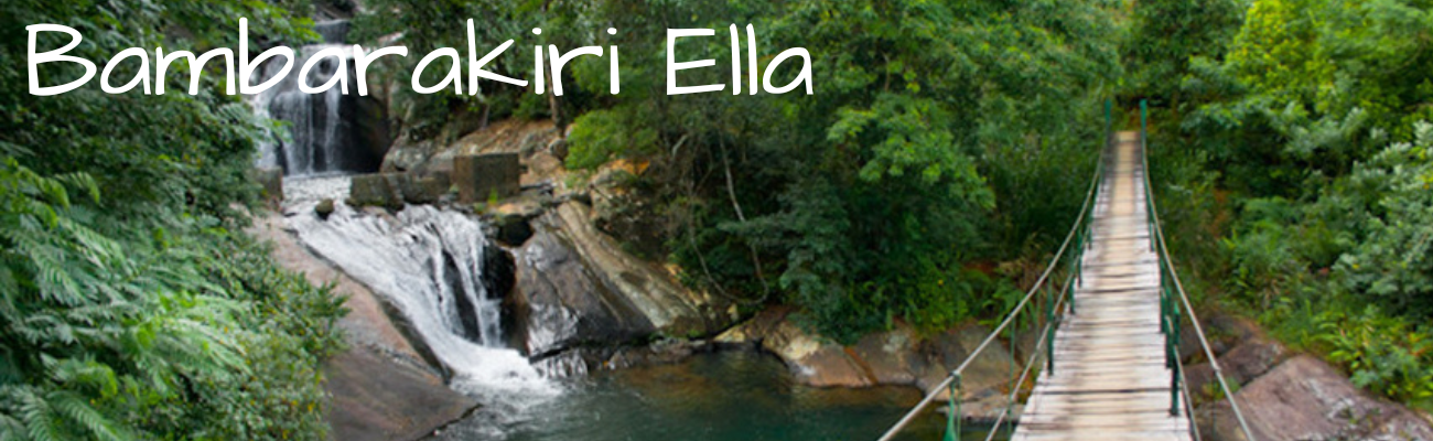
The fall is situated in nearby Rattota town in the Matale District, along the shortcut to Wasgasmuwa National Park. When Take the Matale – Ilukumbura road it can be seen the name board of the Bambarakiri Ella and it take about 1Km to the Bamarakiri Falls bend, which is past Rattota town, where the fall is to be found.
This 3m height fall is set among the enchanting evergreen forest of the Knuckles mountain range, the latter of which is said to resemble the fingers of a clenched fist. A suspension bridge spanning the falls adds the finishing touch to an already beautiful scene.
This fall has created by the Velangaha Oya alias Kuda Oya that is nurturing the Amban ganga and flows along with Dumbara Vally of the district.
The mini Bambarakiri Ella falls is a small fall created on a stream created by spitting the flow of water at the top of the falls. To reach this site, walk few meters in the jungle on the footpath after crossing the suspension bridge that created as the entrance to the Welangaha Watta Village also capturing the eye of tourists who visit to see the natural beauty of this place.
The fall’s popularity as a visitor attraction continues despite the fact that up to May 2002, 17 people have been killed while the irresponsible behaviors such as either bathing or attempting to clamber over nearby rocks.
Presently, it has acquired a value as a photogenic place due to selection of huge crowd of young couples who expect to get marriage for their wedding photo shoots and pre-photo shoots.
At the nearby Wanarani Colony, a project to provide drinking water for 44 houses was launched under the guidance of three local women.
Bambarakiri Ella also an important place with adorn by beauty of nature and it should be a place that should be visited by visitors in both local and foreign when travel to places such as River- Stone, Pitawala Plain, Mini- Worlds End, Moragahakanda reservoir and fascinating Sera Ella.
ALUVIHARAYA CAVE TEMPLE
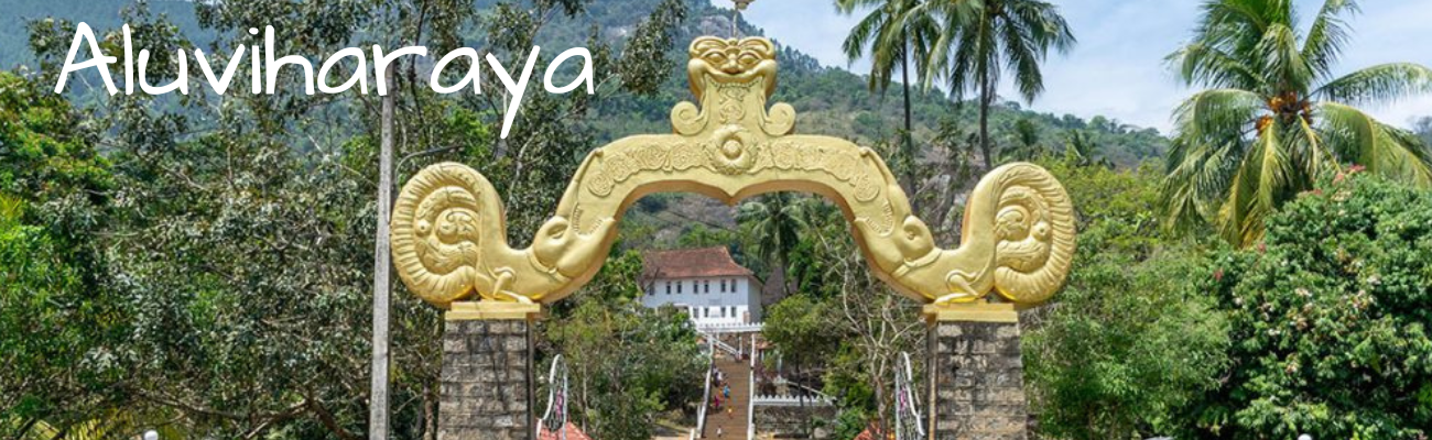
Aluviharaya cave temple in Sri Lanka is a rock-cave temple close to Matale Town. At the entrance of the Aluviharaya cave temple in Sri Lanka is a solid Pandal with an arch constructed out of concrete it leads to a steep climb of stone steps leading to the Meda-midula — the frontage terrace. Then from there, rise stone steps making way to the drip ledge rock caves.
Aluviharaya where Buddhist monks wrote the Tripitakas during King Walagamba’s rule. Buddhist monks wrote some of these old Thripitaka on Ola leaves in Pali. On its apex is written in bold Sinhala letters. These Tripitakas originally had come down by mere word of mouth by being committed to memory by Buddhist monks of the time. Such Tripitakasare classified into three divisions. They are:
1) Vinaya Pitakaya (Basket of Discipline)
2) Sutta Pitakaya (Basket of Discourse)
3) Abidharma Pitakaya (Basket of Metaphysics)
The Aluviharaya cave temple in Sri Lanka has a library containing a gallery of antiques ranging from Buddhist statues made out of clay, brass, marble, while some of them have been gold plated. There are also very valuable Buddha statues gifted by Siam, Cambodia, China, Japan, and Myanmar, together with other archaeological artifacts. The first cave is about 25 feet long and 10 feet high.
A rock cave shelter harbours an Image House decorated with the typical Makara Thorana (Panadol of Dragon). There are also seated, standing and recumbent Buddha statues of terra cotta, while the murals are adorned with paintings of Jathaka stories. Kandyan period paintings are covering the cave ceilings. A spiral stone staircase ends on its summit where the Sacred Bo Tree stands serenely cloistering an image house in this rock cave. The third cave is met amidst a conclave of rock boulders where is sheltered another rock cave where the Thripitaka were written on Ola leaves by the ancient Buddhist monks and a commodious residence for the present day Bhikkhus arriving from all four quarters.
MORAGAHA KANDA RESERVOIR
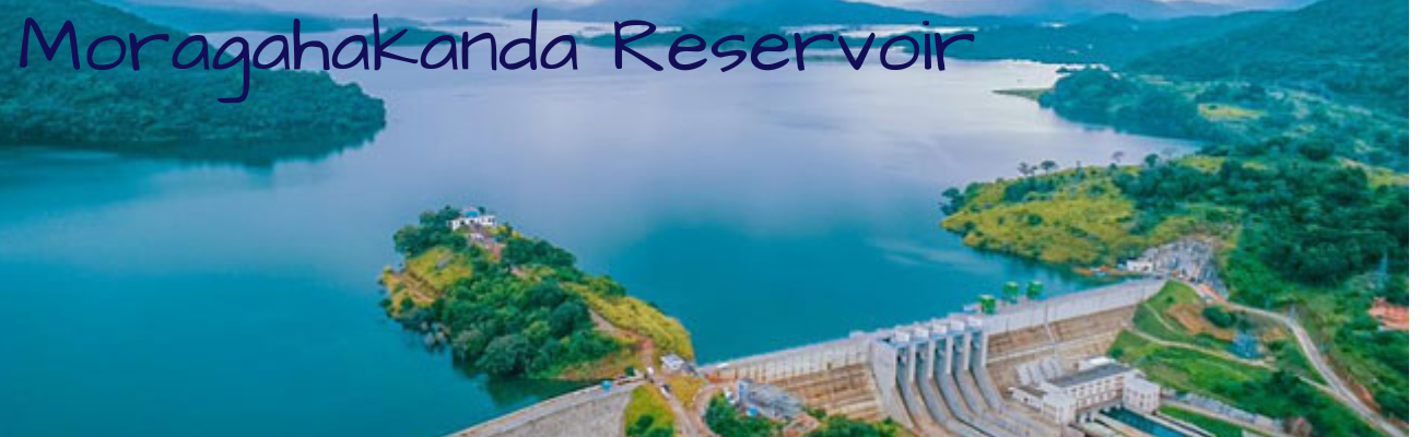
The Moragahakanda Dam, officially as Kulasinghe Reservoir,is a large gravity dam, and the main component of the larger and more complex Moragahakanda — Kalu Ganga Project, across the Ambana River at Elahera, in the Matale District of Sri Lanka. Construction began on 25 January 2007 and was completed in 2018. The maiden waters of the dam was released in January 2017. Morgahakanda/Kaluganga project is the last of the Great Mahaveli project.
The Moragahakanda Dam is a 65 m high gravity dam. The dam created the Moragahakanda Reservoir, which has an active storage capacity of 521,000,000 m3 of water, at a surface elevation of 185 m .
The larger combined project involves the construction of the Moragahakanda Dam and Reservoir, along with the separate Kalu Ganga Dam and Reservoir, for irrigation and power generation purposes. Both these sites would be located approximately 10 km (6.2 mi) apart. development cost is being carried out by SMEC Holdings and Sinohydro.
A granite Buddha statue built opposite the Moragahakanda reservoir was unveiled on 23 July 2018.
Two additional embankment saddle dams will also be built to contain the Moragahakanda Reservoir. The reservoir of the Kalu Ganga Dam will be linked via tunnel.
Water from both, the Moragahakanda and Kalu Ganga reservoirs, will be primarily used to support agricultural needs to an area of at least 81,422 ha (814.2 km2). This will increase rice production by 81% or 109,000 t, amounting to an estimated monetary benefit of US$1.67 million, annually.
Along with the reservoir of the Kalu Ganga Dam, an increase of 64,000,000 m3 of potabal and industrial water supply could be ensured by 2032, to regions including Matale, Anuradhapura, Trincomalee, and Polonnaruwa.
Water from the Moragahakanda Reservoir is used to power the 25-megawatt Moragahakanda Hydroelectric Power Station. The substitution of this hydropower with traditional fossil fuel power generation is estimated to save up to US$ 2.49 billion annually.
The construction of the dam and reservoir also required the construction of multiple access roads and rerouting of existing main roads, as well as the construction of the 300 m (984 ft) long Moragahakanda Bridge. The reservoir has been officially named as Kulasinghe Reservoir, in memory of late Dr. A.N.S Kulasinghe. Deshabandu. Dr. A.N.S Kulasinghe was a Sri Lankan Civil Engineer who served in several projects throughout the country.
LAAKSHA TRADITIONAL INDUSTRIAL VILLAGE AT HAPUVIDA
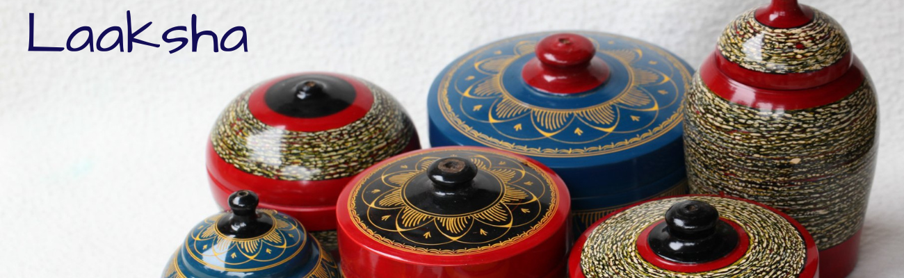
Laksha industry has a special place in Sri Lankan Sinhala culture. They use natural materials for this progress. Even though the stuff that comes out from the Laksha insect is colorless, they add various colors and make them colorful. The difference between a good quality Laksha and a low quality Laksha is that low quality one is breakable, it can be broken by bending it from a hand. Laksha industry can be divided into two parts as Niyapothu wada and pattal wada, but both of these industries have fallen down nowadays. As the new generation is looking for latest jobs and also the Laksha products have been sold in high prices by salesmen, the demand of Laksha industry is reduced. The second we hear the word Laksha we happen to imagine old complex designs, but nowadays the new generation of the society seems to stick with charm, creative designs. Moreover, that effects the Laksha industry as well.
The colors of the campaign which going be used are warm colors. The reason for using yellow color is they use yellow color as the basic color for Laksha Pattal industry, and they apply other colors on top of it. The name “Laksha” has been designed in-between two rows in the logo, it is because it was inspired by old cultural designs. In this logo, some of the parts in the name “Laksha” been designed out from the two rows. It shows the charmness and the freedom. Even inside of the logo, there can be seen red, yellow, orange and black colors, which are warm colors.
Laksha industry has a special place in Sri Lankan Sinhala culture of Matale hapuwida is very famous for Laksha. This industry can be named as an industry that comes from generation to generation. There are two parts as Laksha Pattal wada and Niyapothu wada. (Nail Work). Since niyapothu wada should be done very neatly and carefully, it requires patience. In addition, for Pattal wada there are many hard works. They say that Niyapothu wada are done by women and Pattal wada can be done only by men.
In Pattal wada, every equipment that creator uses from the beginning until he finishes the design are called “Ath Pattalaya”. When they design, mostly they use light colors in first place, such as white, yellow. After that, they use red, blue colors etc. Lastly, they use black color if necessary. Later they design the traditional arts on them by scraping. However, the main material that needs to these two industries is what we take from the Laksha insect, and it seems to sterile. Therefore, they had to import them from India. 1kg is rs.3000 /= and in 1kg we can get 100 Laksha pieces. Since Laksha is colorless, we can add any color and make it colorful.
KAWATAYAMUNA ANCIENT RAJAMAHA VIHARAYA
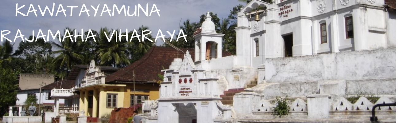
Kawatayamuna temple is located at the Galewela – Matale main road when passing through 9 Km from Palapathwela junction of the Dambulla – Matale main road. Kawatayamuna Rajamaha Vihara is another significant place that attract the eye of tourists both in local and foreign. Ancient chronicles reveal that a part of out of Cholas who brought by King Gajabha from india has made settle in this area and a well-built and muscular person who called kawataya was live among this group of people. The said person has made cultivate and build a strong anicut to obtain water in this area. Accordingly, it has indicated that this area has popularized as “kawatayamuna” in prolonged.
Replica of hell (Apaya) that created and built up in this temple is the most attractive place that draw the attention of tourists. Specially, the schoolchildren are keenly attentive to watch this replica of hell.
Relic’s chamber (sarwagha Dhathu), huge statues of giants called Neelamaha and Nandimithra as well as archaic ola leave books, antique furniture are being exhibited in the Kawatayamuna temple.
SRI MUTHTHUMARI AMMAN THEVASTHANAM (HINDU SHRINE)
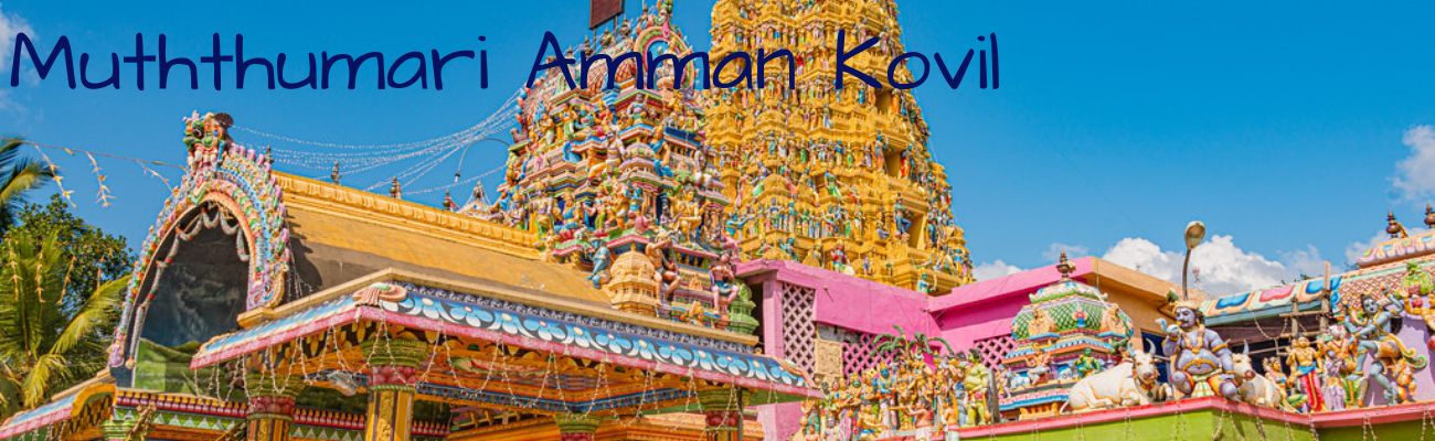
Sri Muththumari Amman hindu shrine is a popular religious center which is subjected to the respect and devotion of devotees in both local and foreign. This Kovil (Shrine) has located near the bus stand at banyan tree at Mandandawela of Matale. Though it has mentioned that Pandyan who came to invade this country in Walagamba era were hindu devotees and this shrine has created to fulfill their wishes as they were hindu devotees. However, the written evidence has not came across. In addition, it has indicated in chronic that the shrine was built on the necessity of invaders who came in king Gajaba’s era. Further, it can be guessed that this shrine has constructed for parts of indian people who came to this country for invasion or for any other activities in ancient time to accomplishing of their worshiping of Goddess Paththini and God Shiva.
Muththumari Amman alias Goddess Paththini was published as a goddess who believe in chaste. According to the chronic wife of hermit, Ayinmanthani who called as Renuka has worshiped later as goddess Paththini.
However, god Sun made fall a rain when Devi Renuka got ready to sacrifice herself by leaping to the pyre of hermit Ayinmanthani with devotion to the chaste, she had burn sores on her body. Then, People of the area got action to cure sores by Magosa leave and to provide foods such as white rice floor, Juggary, ghee, King- Coconuts and milk and required cloths to her. It caused to cure her sores and to console her heart. As mentioned in the chronic After that, God Shiva appeared in front of her and ordered to attain to cast away the sorrow of people. God Shiva was further inform her that people would suffer from a painful disease that occur like burning sore (cambium) and it is a disease of god. Then disappeared after reveal that Magosa leaves are better medicine to cure this disease and foods such as white rice floor, Jaggery, ghee, King- Coconuts and milk (Things that given to Renuka by people) are suitable to heal this ailment. Suddenly, burning sore spots on the body of Devi Renuka has become as powerful of pearls and since that day, she was popular as Muththumari Amman.
Thus, a story has coined regarding the goddess Paththini who was an ardent devote for chaste. Goddess Paththini, called as Kannagi who live as ardent chaste regarding her husband Kovalan. Unfortunately, Kovalan had a secret affair with gesture called Madavi and he made destroy all of his wealth. Finally he was back to his wife Kannagi and at that time she offered her anklet which made by gems and gold. Meantime, gold anklet of the queen of the country was stolen by someone and Kovalan was accused for the misdeed as he had gold anklet which given by Kannagi. Therefore, Kovalan had to face penalty of death though Kannagi has pleaded in front of the king by telling the impeccability of Kovalan. Kannagi was burn by anger after the death of Kovalan and she cursed for the people of Madurapura through setting fire by trashing her anklet on earth. The said fire burned Madurapura city and most of people in the city were dead except meritorious people. Kovalan also received his life again due to the power of chaste of Kannagi. Accordingly, it has mentioned in the chronic that Kannagi was became as an adorable and noble character as Goddess Paththini among the peoples due to this reason.
The shrine that established in minor scale was enhance to peak at present This kovil was established about 200 years ago by the Hindu community specially the South Indian traders who did business around Matale town and tea estates.. The history of this kovil records that a cute little child was seen at the present premises of this kovil and on the following day, a beautiful dress was found in the premises, which the cute little child wore.
On the same day, at night Goddess Pattini had appeared in a dream of one Nallamuttu, and the Goddess Pattini had told Nallamuttu the child who was seen at the premises was Goddess Pattini and had requested Nallamuttu to make this premises a holy place for Hindus. Since then this place became a Hindu kovil.
In the months of February or March, the annual 'Theru' festival is held to evoke the blessings of gods and specially Goddess Pattini. Devotees of India are also coming to visit for the “Theru” Festival that held annually in this shrine. Architectural art of India can be noticed in this shrine as it has created by south Indian artisans.
The early morning 'poojas' start at dawn with the hoisting of the flag. The morning 'poojas' go on till about noon. The evening 'poojas' start at six and continue till mid-night. Thousands of devotees flock to this kovil to offer 'poojas'.
The 'Theru' carts or the chariot ceremony is held on the 25th day which usually falls on a full moon day. The statues of Lord Murugan, Sivan Ambal, Shri Ganeshan, Shandeshulary and Goddess Pattini are kept in five beautifully illuminated and decorated chariots drawn by devotees, both Hindus and Buddhists, are taken along the streets in the day time.
The feeble and the sick who cannot visit the kovil to offer 'poojas' are believed to be visited by Goddess Pattini at their door-step.
Long ago before the chariots were made the statues of gods were taken around the kovil premises on the shoulders of the devotees.
Later the Hindus with the help of Buddhists, Muslims and Christians collected funds to build a chariot to take Goddess Pattini around the streets. Later three more chariots were added now there are five chariots.
This year the 'Theru month' started on January 31 with the 'kap' planting ceremony. During the holy month devotees from all parts of Sri Lanka and South India come to this kovil to offer 'poojas' and get the blessings.
OFFERINGS (POOJA)
Numbers of special offerings are being held monthly in this Church. However, the “Theru” Festival that conduct in every march is an exceptional event out of every offerings. This Festival that commence in year 1955 and firstly, it has organized as a sacrifice Ceremony. Later the system has refused and 'Theru' carts are taken along the streets in the day and night time.
Offerings continuing monthly in Sri Muththumari Amman Thevasthanam
January - Thaipongal Festival, Warshabhishegam Festival
February - Theru Festival & Maha Shiva Rathree Festival
March - Theru Festival, Panguni Uththaram Festival
April - Hindu New year Festival
May - Weigassi Visagam Festival
June - Manikkada Wasagar Festival,Aniuththaram Nadeshan Abhishegam Festival
July - Veil Festival
August - Sri Muththu Minadi sameda Festival
September- Navarathri Festival – Satheeshwara Mahayagam Festival
October – Deepavali Festival
November - Somachara Festival
December – Arunthira Darshana Festival
FORT MACDOWALL
FORT MACDOWALL
Fort MacDowall was located in Matale. The fort has expanded through 16 acres of lands and it has existed a retaining wall that height 5 feet around the whole plot of land. It was a fortified outpost during the Kandyan Wars, named after Major General Hay MacDowall, the 6th Commander of British Troops in Ceylon. The fort was one of the few inland forts constructed by the British and was completed in 1803.
During the Matale Rebellion, on 28 July 1848, the fort came under siege by approximately 400 rebels led by Weera Puran Appu and Gongalegoda Banda, but the British forces repulsed the attack. The rebels also burnt down a coffee storehouse and ransacked the Matale Kachcheri destroying the tax records. On 29 July 1848, the then British Governor, Viscount Torrington, declared martial law over the area. British troops (the Ceylon Rifle Regiment), under the command of Captain Albert Watson, were sent from Kandy, on 28 July 1848, together with the 19th Regiment, commanded by Captain Lillie. On 29 July 1848 the British attacked the rebels' stronghold on the Wariyapola Estate, massacring the peasants and subsequently recaptured and occupied Matale’s administrative center. In the resultant suppression of the resident population, Captain Watson and Captain Lillie rounded up a number of rebel leaders in and around Matale, including Kudapola Sri Rahula Thero, Puran Appu and Gongalegoda Banda. The initial government reports indicated that only thirteen rebels were killed at Wariyapola and a further nine rebels executed and buried within Fort MacDowall. Governor Torrington later admitted, "That the total number killed and wounded amounted to little less than two hundred", although unofficially the numbers are purportedly higher. The only physical remnants of the fort that exist today are the gateway and portion of the ramparts. The interior of the fort is currently used as the Matale cemetery, which includes a monument to the rebellion.
RIVERSTON PEAK
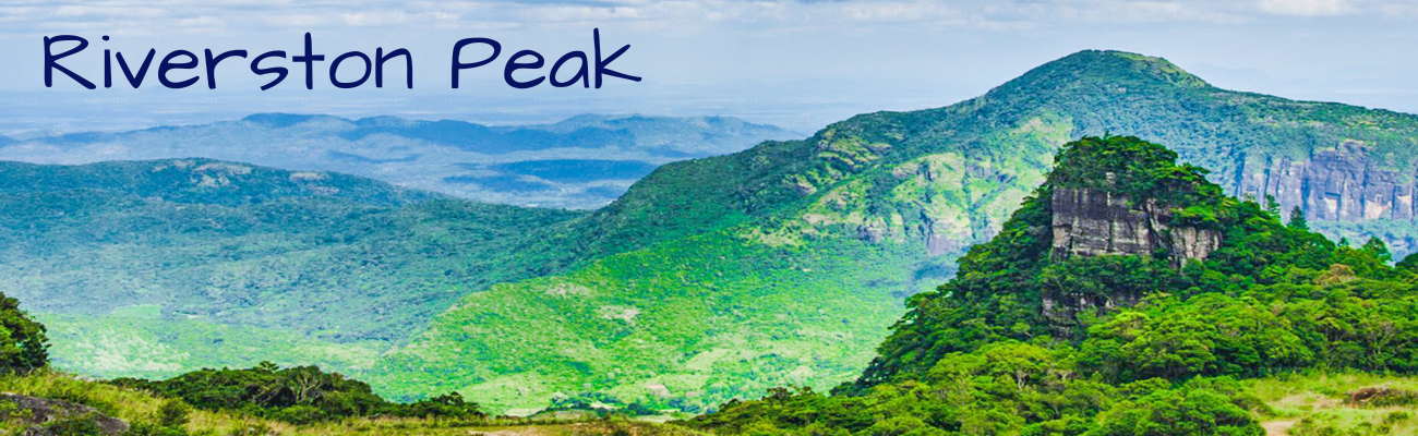

The Riverston Peak of Sri Lanka can be reached by travelling, about 30km away from the Matale town, down the Matale – Girandurukotte Road. This secretive windy road, with its sharp hairpin turns, offers some of the best views to the surrounding countryside to the extent that denoted as the Mini World’s End. Though it is very popular among locals, the area is comparatively unknown amongst mainstream tourists. Therefore the area offers up the natural beauty of Sri Lanka; fresh, green and unpolluted by vendors, tourists, garbage and unsightly buildings.
With climates very similar to the Hortons Plains, where the World’s End is located, Riverston trek also offers two graceful waterfalls Sera Ella and Bambarakiri Ella. Sera Ella also has some conveniently located rock seats from which a visitor can enjoy the refreshing cold spray of misty droplets. The nearby freshwater river, Thelgamu Oya, can be used for quick cooling dip or even just a refreshing splash before or after a long arduous trek.
The trek is about two and a half kilometers one way, and shouldn’t take more than a healthy hour or two at most. It runs a section known as the Pittawala Paththana and leads to the Riverston Peak. The countryside along the trek has views of the terraced paddy fields, unique to some mountainous regions around the world, and that of the beautiful green Central Highlands.
The Riverston Peak features a sheer 300m drop to stunning misty views of the nearby Knuckles Mountain Range and Thelgamu river valley. The peak, with its peaceful and beautiful surroundings, is also a great place to meditate and relax on your holiday to Sri Lanka. The Riverston trek is a great opportunity for nature lovers and photographers who want a few jaw-dropping clicks.
MENIKDENA
When traveling from Matale to Dambulla on the A9 road, the Menikdena Pabbata temple is found at a distance of two kilometers from the Pannampitiya intersection between Naula and Dambulla. According to archaeological evidence, AD Around the 5th century, this battle lasted until the 12th century.
The Menikdena Pabbatha Vihara is located about one mile from the Pannampitiya junction near the 39th milepost of the Vagpanaha Pallesiya Patthu in Kandapalla Korale, Matale District. According to archaeological evidence and chronicle information, AD. It is said that this battle started around the 5th century and lasted until the 12th century. This is a temple land as well as a forest garden spread over 60 acres of land.
A monastic complex surrounded by a wall consisting of four main religious buildings namely Chaitya, Bodhigara, Patimagara (Idol House, Pratima House) and Uposathagara (Pohoya House) is called Pabbata Vihara. Besides, natural or artificial waterways, monks' dormitories, dining halls, water baths and latrines and other constructions are included in the design of this monastery complex. Pabbata Viharaya or Pabbata Monastery (Rock-Monastery or Mountain Temple) was called Pavata Vihara, Pow Vehera, Giri Vehera etc. and the Sanskrit word Parvata is interpreted as Pabbata in Pali and as Pow in Sinhala.
One of the legends that exists among the people living near this land is that the land where the body of Maliyadeva was buried was the source of the gems that are set with gems.